|
| Nevada County |
|
|
| October 2003 |
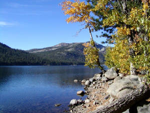
Autumn at Donner Lake, near Truckee. This beautiful lake was where the tragic Donner Party met
its fate in the winter of 1846-47.
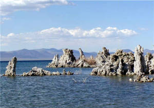
This is Mono Lake, with its strange "tufa" formations. Water levels at this ancient lake are recovering
nicely, thanks to a 1994 court decision that halted decades of diversion by the City of Los Angeles.
| Placer County |
|
|
| October 2003 |
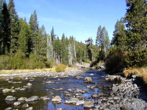
The Truckee River, from a spot south of Squaw Valley. The Truckee gets quite a bit bigger and faster in the spring,
when the snowpack of the Sierra Nevada begins to melt.
| Sierra County |
|
|
| October 2003 |
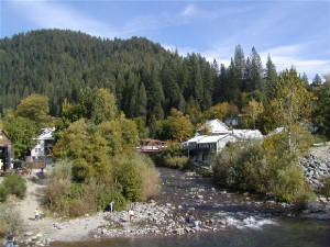
The former gold mining town of Downieville (pop. 325), at the north end of Highway 49. Two rivers -
the North Yuba and the Downie - converge at this historic and picturesque little town.
|
 |
|
|
|
|
|
|
Alpine, Sierra, Nevada, Mono, Placer and El Dorado Counties.
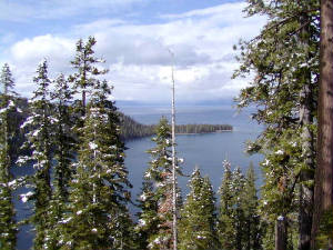
| El Dorado County |
|
|
| April 2002 |
Gorgeous and popular Lake Tahoe, viewed through the snow-tipped trees above Emerald Bay.
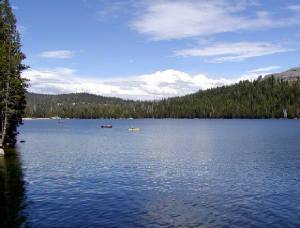
High up in the Central Sierra Nevada at around 7,300 feet, this is Lake Alpine. The road to Lake Alpine, SR 4,
closes during the winter. Nearby is the small community of Bear Valley.
|
|
|
|
|